For the Adventurous

Bikepacking Routes

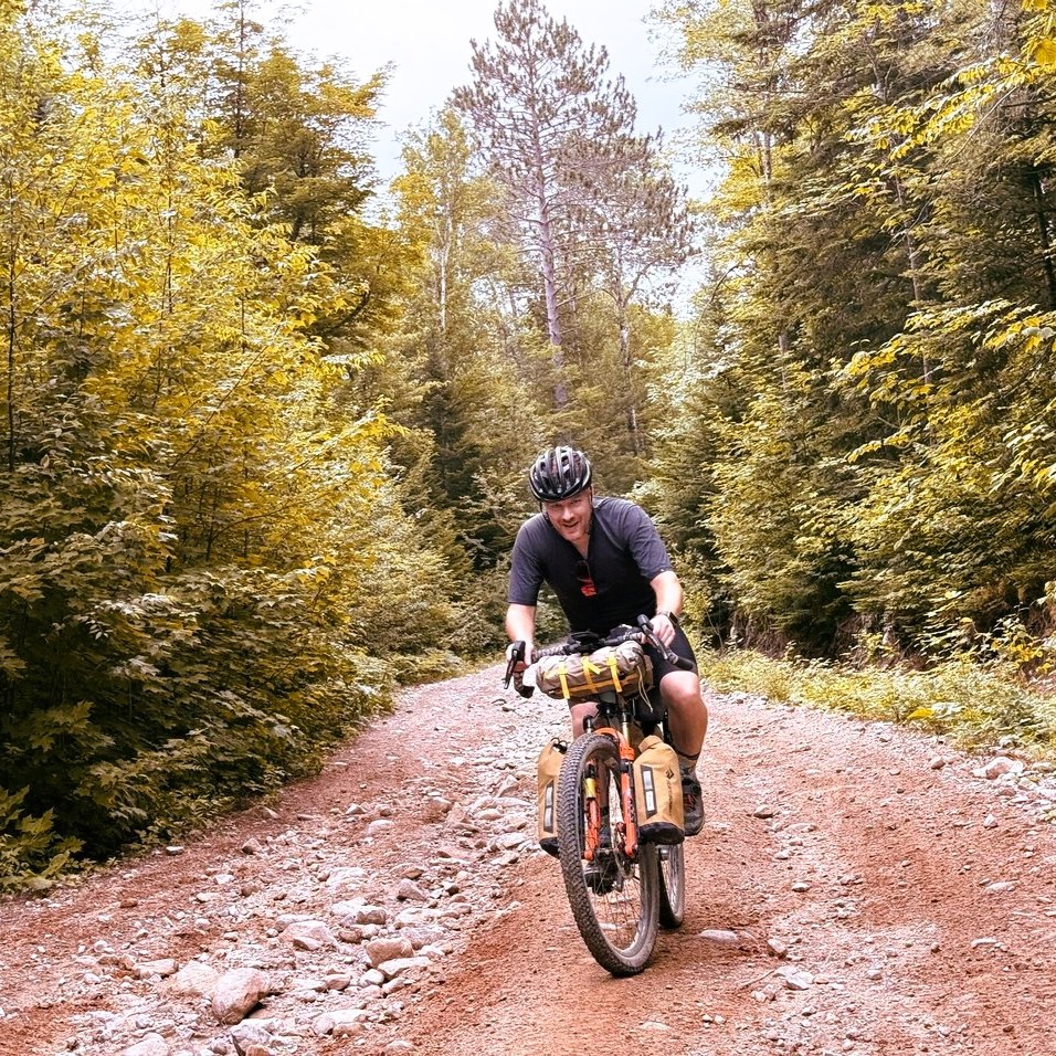
Looking for some bikepacking adventures in your own backyard? Trying to build up to longer and more exciting adventures? Below are some of Bikepack Adventures’ favourite routes.

We’ve been hard at work putting together routes throughout the region, ranging in difficulty from 1-2 day to multi-week challenges. These are not just routes we’ve developed, but the amazing creations of adventures in the local area and beyond.

As an estimate I have calculated between 80km – 120km as a typical day of riding, depending on the route conditions. This will vary based on the rider’s fitness and skill levels.

icon of the length of a bikepacking route
134km
Icon of elevation gain on a bikepacking route
2200m
Icon of gravel and paved bikepacking route
59%

Ouareau Calling

This route was created by:

Chris Panasky, host of the Bikepack Adventures Podcast and Carl Presseault.

icon of the length of a bikepacking route
252
Icon of elevation gain on a bikepacking route
2958
Icon of gravel and paved bikepacking route
81

Canadian Shield 250

This route was created by:

Chris Panasky, host of the Bikepack Adventures Podcast.

icon of the length of a bikepacking route
301km
Icon of elevation gain on a bikepacking route
1,159m
Icon of gravel and paved bikepacking route
38%

Bikes, Boats and Bridges

This route was created by:

Chris Panasky, host of the Bikepack Adventures Podcast.

icon of the length of a bikepacking route
1360km
Icon of elevation gain on a bikepacking route
19,459m
Icon of gravel and paved bikepacking route
87%

Caves and Coves TT

This route was created by:

Robert Biron, Salty Beard Adventures.

icon of the length of a bikepacking route
642km
Icon of elevation gain on a bikepacking route
9880m
Icon of gravel and paved bikepacking route
61%

Great Northern Peninsula Bikepacking Loop

This route was created by:

Malcolm Simpson, the SlowBiker.

icon of the length of a bikepacking route
883km
Icon of elevation gain on a bikepacking route
5211m
Icon of gravel and paved bikepacking route
94%

Newfoundland T'Railway

This route was created by:

Malcolm Simpson, the SlowBiker.

icon of the length of a bikepacking route
550km
Icon of elevation gain on a bikepacking route
3874m
Icon of gravel and paved bikepacking route
52%

The Hurt'n Albert'n 550

This route was created by:

Justin Chadwick and Trevor Anderson.

icon of the length of a bikepacking route
720km
Icon of elevation gain on a bikepacking route
9148m
Icon of gravel and paved bikepacking route
72%

Alberta Rockies 700 Classic

This route was created by:

Jonathan Hayward.

icon of the length of a bikepacking route
512km
Icon of elevation gain on a bikepacking route
8270m
Icon of gravel and paved bikepacking route
67%

Alberta Rockies 500

This route was created by:

Jonathan Hayward

icon of the length of a bikepacking route
691km
Icon of elevation gain on a bikepacking route
10534m
Icon of gravel and paved bikepacking route
80%

Alberta Rockies 700

This route was created by:

Jonathan Hayward.

icon of the length of a bikepacking route
1066km
Icon of elevation gain on a bikepacking route
11600m
Icon of gravel and paved bikepacking route
67%

BC Epic 1000

This route was created by:

Lennard Pretorius

icon of the length of a bikepacking route
142km
Icon of elevation gain on a bikepacking route
1600m
Icon of gravel and paved bikepacking route
82%

A Day in the Gats

This route was created by:

Chris Panasky, host of the Bikepack Adventures Podcast.

icon of the length of a bikepacking route
1,209km
Icon of elevation gain on a bikepacking route
15,605m
Icon of gravel and paved bikepacking route
80%

Canadian Shield Bikepacking XL

This route was created by:

Chris Panasky, host of the Bikepack Adventures Podcast.

icon of the length of a bikepacking route
85km
Icon of elevation gain on a bikepacking route
957m
Icon of gravel and paved bikepacking route
75%

Dirty Mayo

This route was created by:

Grant Burke

icon of the length of a bikepacking route
909km
Icon of elevation gain on a bikepacking route
12,500m
Icon of gravel and paved bikepacking route
78%

Canadian Shield Bikepacking Route

This route was created by:

Chris Panasky, host of the Bikepack Adventures Podcast.

icon of the length of a bikepacking route
338km
Icon of elevation gain on a bikepacking route
3848m
Icon of gravel and paved bikepacking route
68%

Northwest Quebec Explorer Light

This route was created by:

Chris Panasky, host of the Bikepack Adventures Podcast.

icon of the length of a bikepacking route
604km
Icon of elevation gain on a bikepacking route
7236m
Icon of gravel and paved bikepacking route
66%

Northwest Quebec Explorer

This route was created by:

Chris Panasky, host of the Bikepack Adventures Podcast.

icon of the length of a bikepacking route
397km
Icon of elevation gain on a bikepacking route
6330m
Icon of gravel and paved bikepacking route
80%

Canadian Shield 400

This route was created by:

Chris Panasky, host of the Bikepack Adventures Podcast.

icon of the length of a bikepacking route
3057km
Icon of elevation gain on a bikepacking route
35,837m
Icon of gravel and paved bikepacking route
80%

Quebec Bikepacking Traverse

This route was created by:

Etienne Théroux.

icon of the length of a bikepacking route
130km
Icon of elevation gain on a bikepacking route
1019m
Icon of gravel and paved bikepacking route
90%

Almonte Gravel Express

This route was created by:

Chris Panasky, host of the Bikepack Adventures Podcast.

icon of the length of a bikepacking route
565km
Icon of elevation gain on a bikepacking route
2821
Icon of gravel and paved bikepacking route
69%

Blazing Saddles

This route was created by:

Tiago Varella-Cid

icon of the length of a bikepacking route
200km
Icon of elevation gain on a bikepacking route
895m
Icon of gravel and paved bikepacking route
85%

Full Frontenac

This route was created by:

Adrian Grant of www.ridegravel.ca

icon of the length of a bikepacking route
384km
Icon of elevation gain on a bikepacking route
2663m
Icon of gravel and paved bikepacking route
84%

Full Frontenac XL

This route was created by:

Adrian Grant of www.ridegravel.ca

icon of the length of a bikepacking route
293km
Icon of elevation gain on a bikepacking route
2307m
Icon of gravel and paved bikepacking route
94%

Sharb Echo Scramble

This route was created by:

Paul Galipeau at Decent Diversions.

icon of the length of a bikepacking route
731km
Icon of elevation gain on a bikepacking route
7000m
Icon of gravel and paved bikepacking route
80%

Hasty Highlander

This route was created by:

Matthew Kadey, creator of Bikepacking Ontario.

icon of the length of a bikepacking route
770km
Icon of elevation gain on a bikepacking route
8137m
Icon of gravel and paved bikepacking route
65-83%

North of Seven 770

This route was created by:

Justin Ross, Kieran Andrews and Brayden McGregor

icon of the length of a bikepacking route
304km
Icon of elevation gain on a bikepacking route
2894m
Icon of gravel and paved bikepacking route
75%

The Full Monty

This route was created by:

Durham Destroyer

icon of the length of a bikepacking route
100km
Icon of elevation gain on a bikepacking route
810m
Icon of gravel and paved bikepacking route
90%

The Rookie Route

This route was created by:

Durham Destroyer

icon of the length of a bikepacking route
161km
Icon of elevation gain on a bikepacking route
1994m
Icon of gravel and paved bikepacking route
80%

I'm Not Worthy

This route was created by:

Durham Destroyer

icon of the length of a bikepacking route
119km
Icon of elevation gain on a bikepacking route
699m
Icon of gravel and paved bikepacking route
50%

Lake to Lake (Sibbald Point to Pickering)

This route was created by:

Michael Nyby

icon of the length of a bikepacking route
120km
Icon of elevation gain on a bikepacking route
750m
Icon of gravel and paved bikepacking route
71%

Lake to Lake (Pickering to Sibbald Point)

This route was created by:

Michael Nyby

icon of the length of a bikepacking route
160km
Icon of elevation gain on a bikepacking route
548m
Icon of gravel and paved bikepacking route
80%

Simcoe County Loop Trail

This route was created by:

Tourism Simcoe County.

icon of the length of a bikepacking route
700km
Icon of elevation gain on a bikepacking route
2432
Icon of gravel and paved bikepacking route
57%

Great Southwest - All the shortcuts

This route was created by:

London Centennial Wheelers Touring

icon of the length of a bikepacking route
1018km
Icon of elevation gain on a bikepacking route
3292m
Icon of gravel and paved bikepacking route
85%

Great Southwest

This route was created by:

Leif Maitland of the London Centennial Wheelers Touring

icon of the length of a bikepacking route
210km
Icon of elevation gain on a bikepacking route
2450m
Icon of gravel and paved bikepacking route
54%

King to Brockton

This route was created by:

Theo Kelsey-Verdeccia.

icon of the length of a bikepacking route
260km
Icon of elevation gain on a bikepacking route
4000m
Icon of gravel and paved bikepacking route
53%

The Motherlode

This route was created by:

Thiago Varella-Cid.

icon of the length of a bikepacking route
373km
Icon of elevation gain on a bikepacking route
3128m
Icon of gravel and paved bikepacking route
75%

Grand Nith Ramble

This route was created by:

Matthew Kadey, curator of Bikepacking Ontario.

icon of the length of a bikepacking route
415km
Icon of elevation gain on a bikepacking route
3100m
Icon of gravel and paved bikepacking route
75%

Farmer's Folly

This route was created by:

Matthew Kadey, curator of Bikepacking Ontario.

icon of the length of a bikepacking route
804km
Icon of elevation gain on a bikepacking route
8800m
Icon of gravel and paved bikepacking route
73%

Log Driver's Waltz

This route was created by:

Eric Betteridge and Jen Adams of The Log Driver's Waltz

icon of the length of a bikepacking route
790km
Icon of elevation gain on a bikepacking route
7600m
Icon of gravel and paved bikepacking route
85%

BT700

This route was created by:

Matthew Kadey, curator of Bikepacking Ontario.

Level of Difficulty

Rather than re-creating an entirely new system of grading the difficulty of a bikepacking route, we at Bikepack Adventures have decided to use the grading system created by Bikepacking Roots.
The difficulty is broken down into 2 main components: Physical difficulty and Technical difficulty. This is given an overall average out of 10 in the key stats part of the route, but is described more fully in the tabbed section under the heading “Difficulty”.
For more details, read the article Rating the Difficulty of Bikepacking Routes in my blog.

Disclosure

Be aware that all routes published, posted and linked to are unsupported and unsanctioned with no insurance provided. All riders are responsible for their own personal well-being when riding on any of the routes on the Bikepack Adventures website and do so at their own risk.
The route developer takes no responsibility for personal injury, damage to personal property or any other circumstance that might happen to individual riders cycling these route. There is no guarantee of route conditions at any given time and the route developer takes no responsibility for disrupted route conditions.
You are entirely responsible for your own safety and decisions that are made including accommodation and necessary detours. It is advised to study route maps and make note of your supply options as well as possible detours.
If you are not comfortable riding a section of a route, take any necessary alternatives. Planning and due diligence is imperative as is riding within your means.  People “racing” the route do so at their own risk.

Amazing Companies that Support

Bikepack Adventures

Redshift SportsTailfin LogoRaceday Fuel